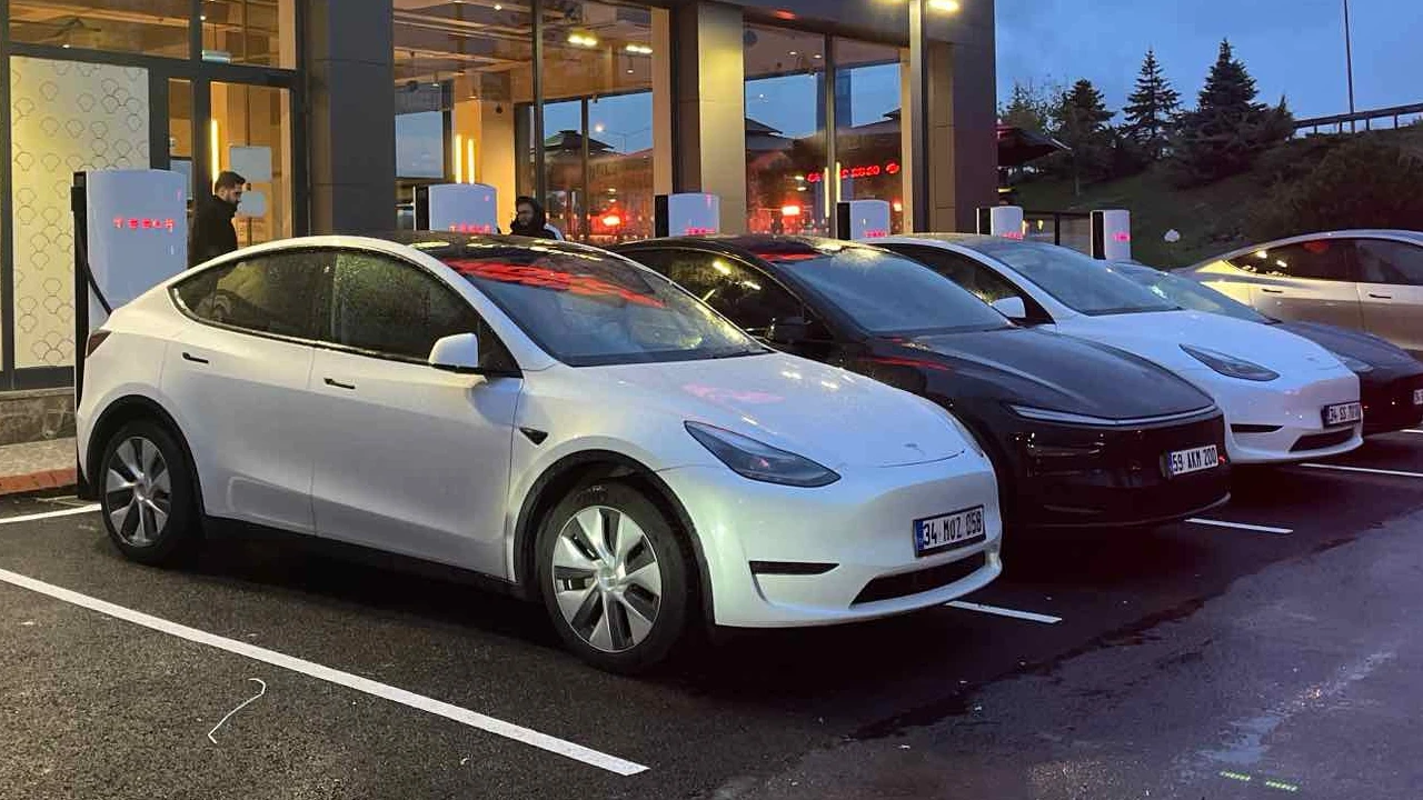
Tesla and Google are solving a significant problem for electric vehicle users. Google Maps has integrated live occupancy information at Tesla’s Supercharger stations. This new feature will make finding and planning charging stations much easier and more accurate for all electric vehicles using Tesla’s Supercharger network.
Tesla Supercharger Occupancy Information is Now Live on Google Maps!
Google Maps already displays live data, such as a “popular times” card, in high-traffic locations like restaurants. Now, it’s bringing this functionality directly to Tesla’s charging infrastructure. According to Tesla, Google Maps has officially integrated the company’s live charging occupancy data into its app. A new pill-shaped indicator will appear in the user interface’s location information tab in Google Maps.
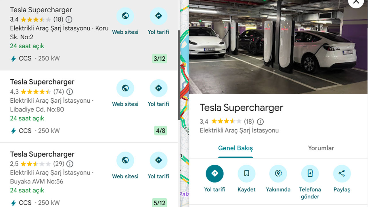
This indicator will include:
Charging Rate: Information about the charging rate offered by the station.
Current Availability Counter: A fractional representation of the total number of chargers and the number currently in use. For example: 8 / 12 (8 out of 12 chargers are in use).
If a Supercharger location has more than one charger type or speed, the tab will display the availability information for each speed type separately.
This new availability meter is available on all platforms where Google Maps works:
- Android and iOS devices
- Android Auto
- Tesla’s in-car display (where the meter is expected to appear in a more central position in the foreground).
Tesla also states that forecasted availability will be available in the future. However, it is not yet clear whether this feature will be exclusive to Tesla’s own trip planning app or will also be offered by Google Maps.
Tesla Supercharger availability information is available on Google Maps starting today.